What are Tectonic Faults?
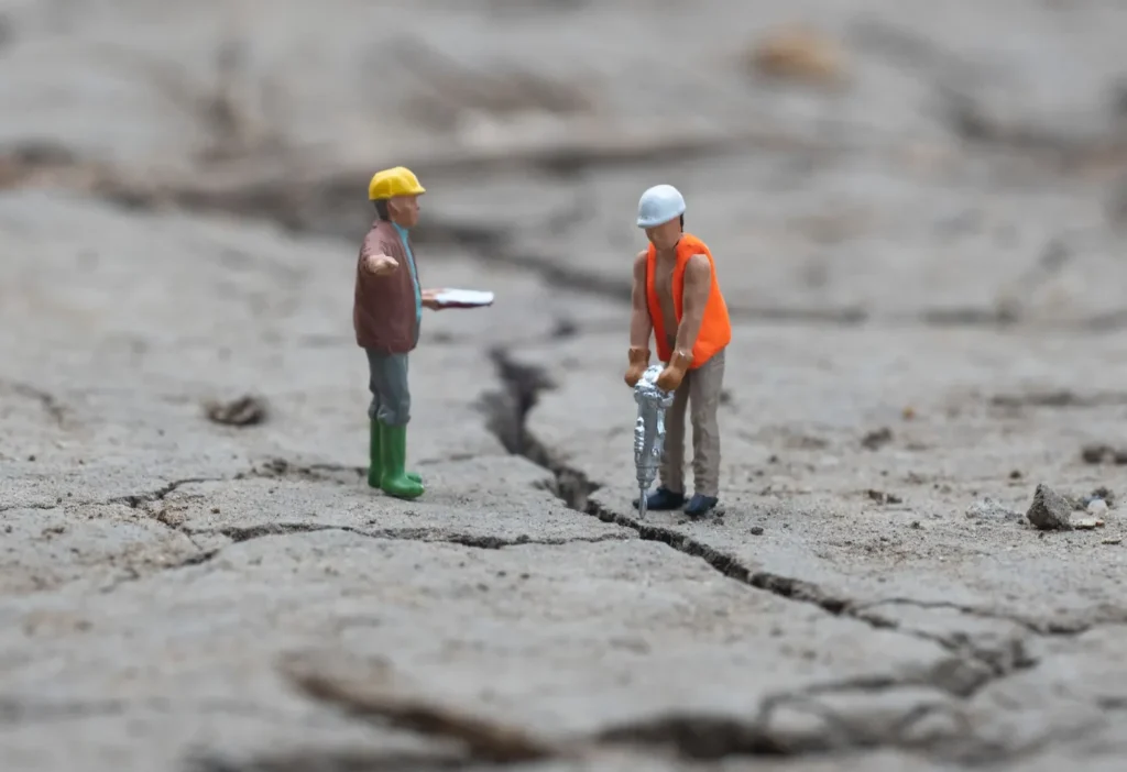
A tectonic fault is a discontinuity in the Earth’s crust structure where two rock blocks move due to geological forces. These faults are common in geologically active areas and are responsible for most earthquakes worldwide. They are prevalent on Earth and are typically found at the boundaries of tectonic plates.
When the accumulated tension along one of these faults exceeds the resistance of the surrounding rocks, energy is released in the form of an earthquake. Therefore, tectonic faults are responsible for seismic movements. Besides their influence on earthquakes, these faults also have a significant impact on the geological configuration of a region and play a crucial role in the formation of geographical features such as mountains, basins, and other land formations.
It’s essential to note that the dimensions of tectonic faults can vary significantly, ranging from small fractures in the Earth’s crust to extensive deformation zones spanning many kilometers. In some cases, these faults may be visible on the Earth’s surface, while in others, they are located underground and can only be detected through specialized geophysical methods.

Classification of Tectonic Faults
Tectonic faults are categorized based on the relative displacement of the involved rock blocks. This displacement can take various forms: compression (when blocks are pushed toward each other), extension (when blocks move apart), or shear (when blocks slide horizontally past each other).
Therefore, they can be classified as:
Normal or Direct Faults: These faults are characterized by one block moving down relative to the other along the fault plane. It is considered a normal fault when the upper block (hanging wall) moves downward in relation to the lower block (footwall). This type of fault primarily originates from the separation of tectonic plates, i.e., through an extension process.

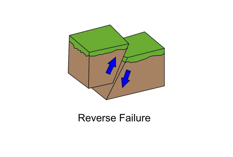
Reverse Faults: Reverse faults cause an uplift of the ground, meaning the block above the fault plane (hanging wall) ascends relative to the block below the plane (footwall). They are called reverse because the forces generating them are compressive, i.e., pushing one block toward the other, causing a rock block to rise along the inclined fracture plane. This movement is contrary to gravity.

Strike-Slip Faults: Also known as transcurrent or transform faults, these faults involve lateral movement parallel to the fault surface, with blocks sliding past each other horizontally. Evidence of these faults in the field often includes rows of displaced trees, river channel shifts, or laterally displaced fences, among others.

Oblique Faults: Also called mixed faults, they are a combination of movements where rock blocks may experience both vertical and lateral displacement along the fault surface. These faults are more complex and can result from different tectonic forces acting simultaneously.

Colombia's Geological Mosaic
The geology of Colombian territory is characterized by its remarkable diversity and complexity, largely due to its location in a region of interaction between multiple tectonic plates and its varied geological history. Colombia is at the convergence point of three major tectonic plates: the Nazca Plate, the Caribbean Plate, and the South American Plate. This situation has given rise to a wide range of geological formations and events over time.
The most notable consequence of this plate interaction is Colombia’s susceptibility to seismic activity. On average, the country experiences around 2,500 earthquakes per month (approximately 80 times a day), but most are not of significant magnitude or intensity. Numerous tectonic faults have been identified within Colombian territory, with the Colombian Geological Service (SGC) documenting over 7,000 geological faults. It’s important to note that most of these faults are inactive and do not pose a significant threat.
However, some of these faults are considered active and have the potential to cause significant damage, including the destruction of cities. Among the main active faults are the Santa Marta-Bucaramanga Fault, the Boconó Fault, the Oca Fault, the Honda Fault, the Ibagué Fault, the Colombia-Ecuador Trench, the frontal fault systems of the Eastern Cordillera, and the Romeral Fault system.

Major Tectonic Faults in Colombia
These active faults are of special concern to authorities and scientists due to their potential to generate significant seismic movements, highlighting the importance of monitoring and proper planning to mitigate seismic risks in Colombia.
The Relationship between Tectonic Faults and Seismic Occurrence in Colombia
When comparing the location of Colombia’s major faults with the seismic threat zones applicable to buildings according to NSR-10, a correlation becomes evident. A higher incidence of faults corresponds to a greater seismic threat, indicating certain standardized soil parameters in that area. These seismic threat parameters are crucial for the study and designs conducted by civil engineers.
By analyzing the geographical position of Colombia’s prominent tectonic faults in relation to seismic threat zones applicable to buildings according to NSR-10 (Title A), a correlation becomes apparent. In other words, the presence and activity of these tectonic faults are directly related to the levels of seismic threat in a specific region. The greater the extent of a fault, the higher the seismic threat faced by that area, indicating certain standardized soil parameters for that region.

Seismic Threat Zones in Colombia
Consequence of Geological Faults: Earthquakes
Earthquakes are a sudden release of accumulated energy in the Earth’s crust due to elastic deformation, resulting in the displacement or deformation of crustal parts and the emission of elastic waves that propagate within the Earth.
The study of earthquakes and the Earth’s structure through naturally or artificially generated seismic waves is known as seismology, which is divided into:
Stricto Sensu Seismology: the use of earthquakes to study the Earth’s interior.
Seismicity: the study of the distribution and mechanism of earthquakes. Seismicity also examines the occurrence of earthquakes over time and space through historical documentation, macroseismic analysis, or seismological interpretation.
Risks and Challenges for Civil Engineering
These seismic threat indicators are of utmost importance for civil engineers as they provide crucial information that influences the study and design processes of structures and buildings. Parameters related to seismic threat, such as the expected maximum seismic acceleration and the soil response to an earthquake, are fundamental factors that engineers must carefully consider when planning and constructing earthquake-resistant (not anti-seismic) infrastructures in areas prone to seismic movements. This data allows engineers to adapt their designs and take appropriate measures to ensure the safety of structures and the protection of human lives in the event of an earthquake.
One of the primary objectives of structures is to provide protection to their occupants. Therefore, it is necessary to comply with the guidelines of the Colombian Seismic-Resistant Construction Regulations (NSR-10) to ensure that buildings suffer the least possible damage during and after an earthquake. In particular, Title A: General Requirements for Seismic-Resistant Design and Construction indicates that the higher the seismic threat level in the region, the greater the energy dissipation capacity the structure must have.

Tectonic faults in Colombia serve as a constant reminder of the geological dynamics shaping our planet.
Civil engineers in Colombia face unique challenges when designing and building infrastructure in these earthquake-prone areas. Geological research and continuous monitoring of faults are critical components for disaster prevention and the safety of the population in a region prone to seismic activity.
Identification of seismic threats: Geological research allows the identification of active geological faults and the assessment of their earthquake-generating potential. This provides essential information to determine the areas at the highest seismic risk in the country. Continuous monitoring of these faults helps detect early signs of seismic activity and predict possible earthquakes.
Risk assessment: Geological research also allows characterizing soil characteristics in areas near tectonic faults. This is crucial because the seismic response of the soil can vary significantly from one place to another, affecting how seismic waves propagate and, therefore, the impact they can have on structures. Soil information is essential for risk assessment and the design of earthquake-resistant structures.
Planning and seismic design: The results of geological research and monitoring of tectonic faults are fundamental for the development of seismic construction codes and for the design of earthquake-resistant infrastructure. Civil engineers use this information to plan and build buildings, bridges, and other structures that can withstand seismic activity.
Early warning: Continuous monitoring of geological faults allows the detection of small tremors and precursor movements that could indicate an imminent earthquake. Through early warning systems, warnings can be issued to the population before the main tremor arrives, giving people time to take safety measures.
Disaster mitigation: Understanding faults and their behavior over time is essential for planning the response to an earthquake. This includes identifying shelter zones, coordinating rescue teams, and preparing the population for seismic events.


Related
What Is Soil Moisture?
Importance of Slope Stability in Engineering
What is Geodynamics? – the study of Earth’s changes