


Civil engineering is a crucial discipline encompassing the design, construction, and maintenance of essential infrastructures for our society, from roads and bridges to buildings and dams. In recent decades, technological advances have left a significant mark on this industry. One of the most notable advancements has been the use of drones and laser scanning for mapping terrains and structures. These innovations have revolutionized how civil engineering projects are approached, enabling greater efficiency and precision at all stages of the process.
What are Drones?

Drones, also known as Unmanned Aerial Vehicles (UAVs), are flying devices that do not require an onboard pilot for operation. These devices can be remotely controlled by an operator or follow autonomously programmed routes.
Equipped with a variety of sensors and cameras, drones can capture images, videos, and data from the air. This versatility makes them valuable tools in various applications, including aerial photography, surveillance, precision agriculture, infrastructure inspection, mapping, and many other areas.
Drone technology has advanced significantly in recent decades, leading to its growing adoption in different sectors, such as construction and civil engineering. Their ability to access hard-to-reach places, efficiently gather data, and perform hazardous or repetitive tasks has made them a valuable tool.
Applications of Drones in Civil Engineering
Drones used in this field are equipped with cameras and sensors for capturing high-resolution images and topographic data. Here are some common applications of drones:
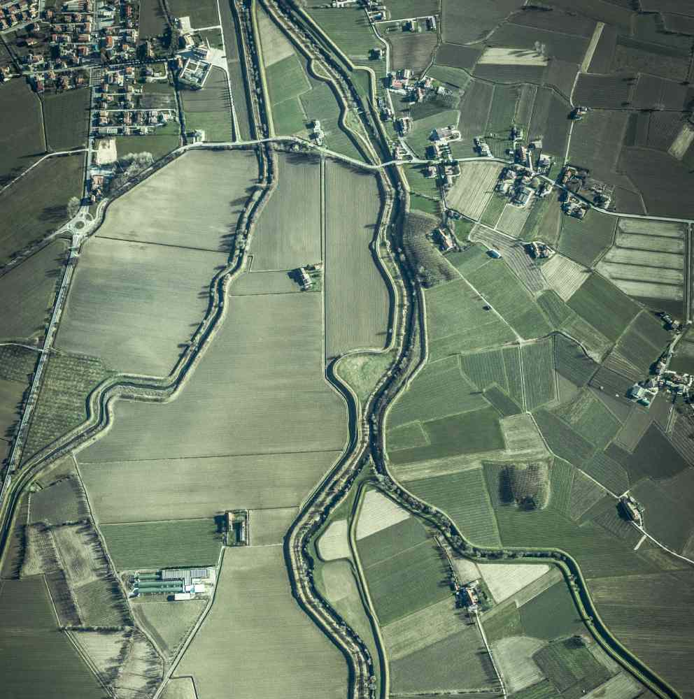
- Topographic Surveying and Mapping: One of the most common uses of drones in civil engineering is generating topographic maps and cartography. Drones can fly over an area and take high-resolution aerial photographs, which are then processed to create Digital Terrain Models (DTM) and Digital Elevation Models (DEM). These data are crucial for the design and planning of construction projects, providing detailed information about the terrain.
- Infrastructure Inspection: Drones are used to inspect and assess the condition of infrastructure such as bridges, dams, roads, and buildings. Their ability to access hard-to-reach areas, like the undersides of bridges or the tops of tall structures, allows for safer and more efficient inspection. High-resolution cameras and sensors on drone’s capture details that can help identify defects or structural damage.
- Project Monitoring: Drones are valuable for monitoring and controlling construction projects by conducting regular flights over the construction site to capture updated images and data. Engineers can compare this data with the original plans, identify deviations, and make timely decisions to keep the project on schedule and within budget.
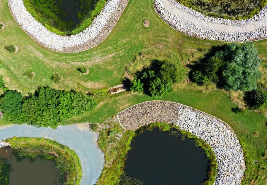
- Natural Resource Management: In projects involving sensitive natural areas, such as national parks or reserves, drones are used to assess environmental impact. They can gather data on flora and fauna, soil erosion, and water quality, essential for compliance with environmental regulations and the conservation of natural resources.
- 5. Geotechnical Studies: Drones can conduct geotechnical studies by analyzing soil composition and stability. This is crucial in construction projects involving excavations, deep foundations, or work in landslide-prone areas.
- Construction Site Safety: Drones are also used to assess safety on construction sites. They can detect potential hazards, identify areas requiring extra precautions, and ensure compliance with occupational safety standards.
- Progress Documentation: Drones capture images and videos throughout the project, enabling the creation of detailed historical documentation. This is useful for tracking project progress, generating reports for stakeholders, and resolving legal disputes.
- Hydrographic Surveys: In projects involving bodies of water, such as port dredging or dam construction, drones can perform hydrographic surveys to measure depths and map the seabed or riverbed.
- Mobility and Traffic Studies: In transportation and traffic projects, drones are used to collect data on traffic patterns, congestion, and vehicle mobility. This is essential for the design and planning of efficient road systems and transportation networks.
Laser Scanning in Civil Engineering

Laser scanning, also known as LIDAR (Light Detection and Ranging), is a technology that operates by emitting laser pulses towards a target and measuring the time it takes for the light to return to the sensor. This allows for the precise calculation of the distance between the scanner and the target object. As the scanner moves, it records a series of data points that, when processed, generate a detailed three-dimensional representation of the scanned object or terrain. This data is used in various applications, including mapping, topography, infrastructure inspection, and urban planning, where precise measurement and detailed mapping are required in civil engineering and other fields.
Applications of Laser Scanning
- 3D Modeling of Terrains and Structures: This is a fundamental tool for creating detailed 3D models of terrains and structures in civil engineering and construction. Laser scanners can capture the three-dimensional geometry of terrains, buildings, roads, and other infrastructure elements with unparalleled precision. These 3D models provide an accurate virtual representation of reality, essential in project planning and design.
Engineers can analyze the terrain’s topography, assess a site’s suitability for construction, and plan road layouts and drainage systems with a precise and detailed database.
- Detection of Changes and Deformations: Laser scanning is used to monitor changes in the shape or structure of buildings, bridges, and other infrastructure over time. By conducting repeated scans over a period, engineers can detect subtle deformations or changes in the position of structural elements. This is crucial for the early identification of potential safety issues, such as the displacement of pillars or the tilting of structures. The ability to detect changes in a structure with sub-millimeter accuracy allows for preventive measures before serious failures occur.
- Quality Control and Precision: Laser scanning is a valuable tool for quality control in construction. It allows for verifying that the executed works conform to the original designs and meet established quality standards. LIDAR data is used to compare actual measurements with plans and detect deviations. This is especially important in high-precision construction projects, such as the construction of suspension bridges or the installation of delicate machinery. LIDAR technology ensures compliance with specifications and safety in construction.
- Assessment of Geological Risks: In areas prone to geological risks, such as landslides, avalanches, or floods, laser scanning is used to assess terrain topography and stability. The obtained data helps identify risk areas and plan prevention and mitigation measures. Digital terrain models generated by LIDAR allow engineers to analyze slope, soil erosion, and other geological factors that can trigger catastrophic events. This significantly contributes to safety and planning in areas vulnerable to natural risks.
Synergy between Drones and Laser Scanning
The synergy between drones and laser scanning has emerged as a cutting-edge technological alliance that is radically transforming how challenges are addressed in fields such as civil engineering, construction, and mapping.
These two technologies, individually, have proven to be exceptional tools for data collection and obtaining precise and detailed information from both the air and the ground. However, it is the combination of drones and laser scanning that takes efficiency, precision, and versatility to new levels. This allows for comprehensive coverage, complementary data collection, continuous monitoring, and safe access to hard-to-reach areas, revolutionizing decision-making and project management in these industries.
Comprehensive Coverage: Drones, equipped with cameras and sensors, can swiftly and efficiently fly over large areas. Combined with laser scanning, which provides detailed and precise ground-level measurements, comprehensive coverage of the area of interest is
achieved. This means that data can be obtained both from the air and the ground, providing a complete and detailed view of the terrain and structures.
Efficiency in Data Collection: Drones can collect data quickly and agilely, saving time and resources compared to traditional methods. For example, in a topographic survey, a drone can cover extensive terrain in a matter of minutes, while ground-based laser scanning could take much longer. The combination of both technologies allows for efficient and complete data collection.
Complementary Data: Drones capture visual and thermal data that can complement the information provided by laser scanning. This is especially useful in detecting changes in vegetation, identifying areas with heat leaks in infrastructure, and assessing the health of vegetation in natural resource management projects.
Higher Spatial Resolution: Laser scanning provides very high spatial resolution, meaning it can capture minute details of structures and terrains. When combined with visual data from drones, an exceptionally precise and detailed representation of the environment is obtained. This is crucial in projects that require precise measurements and a high level of detail.
Mapping is one of the most prominent and valuable applications of this synergy. Such a combination has revolutionized how geospatial data is collected and processed for the creation of accurate and detailed maps, enabling things like:
High-resolution topographic mapping for engineering projects and cartography.
Land use and vegetation mapping in resource management and urban planning.
Mapping urban infrastructure and maintenance.
Rapid response in natural disasters and reconstruction.
Continuous map updates for accuracy.
Water resource management and flood prevention.
Precision agriculture for agricultural optimization.
Benefits of Drone and Laser Scanning Technology in Civil Engineering
Greater Efficiency: Aerial data capture reduces the time required for topographic surveys and project evaluations, resulting in increased operational efficiency.
Improved Precision: Laser scanning technology offers highly accurate measurements, reducing errors in project design and execution.
Cost Reduction: Early detection of issues and the ability to make data-driven decisions reduce costs associated with correcting errors during construction.
Enhanced Safety: Drones enable safer inspections of structures and hard-to-reach areas, ensuring the safety of workers.
Effective Planning and Management: The availability of accurate and updated data facilitates effective planning and management of construction projects.
Minimization of Environmental Impact: The ability to assess environmental impact and implement mitigation measures contributes to the sustainability of projects.
Success Stories Where This Technology Was Implemented
To illustrate how drones and laser scanning have transformed civil engineering, here are some notable success stories:
San Francisco Bridge, California
Drones were used in the reconstruction project of the San Francisco Bridge to inspect structures and monitor construction progress. This allowed for early issue identification and ensured worker safety on a large-scale project.
Three Gorges Dam, China
Laser scanning at the Three Gorges Dam enabled precise monitoring of structural deformation. This ensured the safety of the dam, one of the largest in the world.
High-Speed Train Construction, Europe
In the construction of high-speed train lines in Europe, drones were used for topographic surveys and construction progress monitoring. This helped keep the project within the established timeframe and budget.
Challenges and Ethical Considerations
Regulation: Drone operation is subject to constantly evolving regulations, meaning civil engineering professionals must stay updated on local and national laws governing the use of these technologies. Non-compliance with regulations can lead to legal sanctions and significant fines.
Privacy: Capturing images and data from the air via drones raises legitimate concerns about people’s privacy. Drones can access areas that were previously out of reach for ground cameras, increasing the risk of privacy violations. Engineers and drone operators must ensure compliance with all privacy regulations and obtain appropriate consent when necessary for data collection.
Aviation Safety: Aviation safety is a critical concern when operating drones in areas near airports or in controlled airspace. Collisions between drones and aircraft can have serious consequences. Therefore, strict adherence to rules and regulations is essential to avoid hazardous interference with air traffic and ensure flight safety.
Environmental Ethics: While drone and laser scanning technology can help minimize the environmental impact of construction and development projects, it’s also essential to consider and mitigate any negative impact on the environment. This includes protecting local flora and fauna, assessing environmental risks, and implementing sustainable practices in construction.
Responsible Data Use: The massive data collection by drones and laser scanning raises ethical questions related to the responsible use of this data. Engineers must ensure the security and integrity of collected data, as well as its proper and ethical use. This involves protecting confidential information and considering individuals’ privacy rights.
Social Impact: The introduction of advanced technologies like drones and laser scanning can have a social impact on local communities. This may include the displacement of traditional workers, changes in community dynamics, and the need to address concerns and expectations of local stakeholders.
Equity and Access: The adoption of advanced technologies is not always uniform across all communities. There may be a gap in the adoption of these technologies, raising issues of equity and access. Engineers must consider how to ensure that the benefits of these technologies reach all communities and are not exclusively concentrated in urban or high-income areas.
Conclusion
In conclusion, the synergy between drones and laser scanning has transformed how we collect and use geospatial data across a wide range of applications. From creating high-resolution topographic maps to mapping urban infrastructure and precision agriculture, these technologies have proven their value in civil engineering, natural resource management, and emergency response. The ability to obtain accurate data efficiently has driven efficiency, informed decision-making, and advanced numerous industries.
As technology continues to evolve, we can anticipate a future where the synergy between drones and laser scanning will continue to play a fundamental role in transforming our world and how we understand and use our environment.
Related